Journal Entry
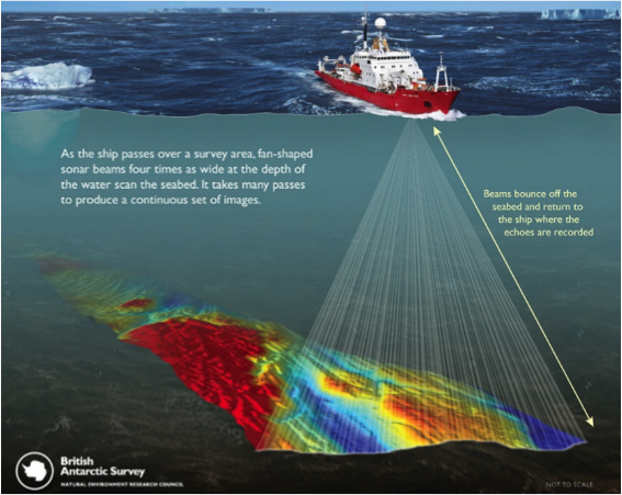
Take a close look at the diagram below, which was produced by the British Antarctic Survey to show how a multibeam works. This is the primary tool we use on the ship to collect information about the shape of the seafloor. Does it remind you of anything? What animals do you think they studied in order to develop this mapping system? I have a few interesting facts I will share with you tomorrow, but take a minute to do some research yourself and tell me something fascinating you learn about the species that were using multibeam technology long before humans ever invented it.
 A ship's multibeam is used to create a detailed map of the seafloor. Image courtesy of the British Antarctic Survey.

Comments
Add new comment