Journal Entry

The past few days have been very busy, so I haven’t had much time to create a blog post. So I’ll catch you up on what we’ve been doing since Friday.

Evidence of Ice Retreat

The sonar bathymetry equipment (for mapping the seafloor depth) is finally working, so we spent the days slowly driving lines in front of the glacier face. We are mapping out exposed sea floor that ten years ago was covered with well over 100 feet of ice. Very clear evidence of a glacier retreating fast due to climate change.

Saturday was gorgeous - warm and sunny, so I was also able to do some drone flying. I took this flight around an outwash plain that was at the very edge of the Kongsvegen Glacier in 2011. Now it is at least a mile in front of this rapidly retreating glacier. Aside from the music, the video is pretty rough. In the next couple of months I’d like to turn this into a little educational video illustrating the different types of features that become exposed once the glacier retreats. I keep reminding myself that this sort of landscape is probably what it looked like in the Boston area around 15,000 years ago as the ice sheets retreated at the end of the last Ice Age!
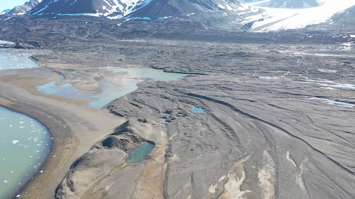
outwash plainThis outwash plain probably looks the way Boston did 15,000 years ago just as the ice sheets were retreating!

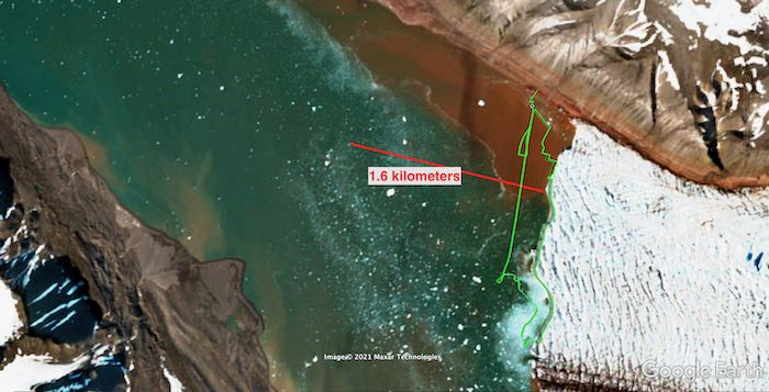
You can see one of my flight paths in the image below, which I brought into Google Earth and overlaid on a very recent satellite image. Then I compared this to a satellite image from August 2011. From these images you can see that the ice margin has retreated around 1.6km (1 mile) in the past 10 years.
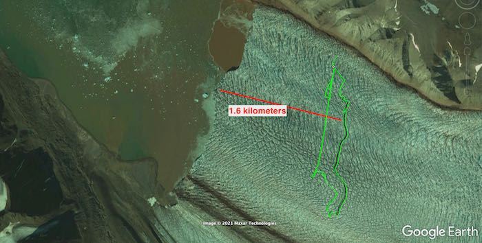
2011 ice marginSatellite image of the Kronebreen and Kongsvegen Glaciers from 2011. Note that the ice is now 1.6km further back. 2021 ice marginSatellite image of the Kronebreen and Kongsvegen Glaciers from 2021. Note that the ice is now 1.6km further back than in the 2011 image.
It’s important to realize that when all that ice retreats, all of that volume is gone. Consider the picture below, where I measured out (using Google Earth) the approximate distance of retreat and the approximate distance across the fjord. From the image it is possible to estimate where the height of the glacier was - by looking for the top of what we call glacial till - all the loose sediments that the glacier has left behind. From the drone estimate that the glacier was about 30 meters above the surface. I’m also making a guess that the glacier was, on average, around 60 meters below the surface.

For my students (and anyone else): Can you calculate the volume of ice that was lost? And how much water would that have added to the ocean, if the water is 90% the volume of ice? (Note that 1 cubic meter is 264 gallons.
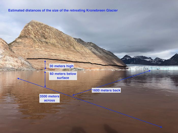
Image showing ice retreatThis image shows how far back the ice from Kronebreen Glacier has retreated. Use the values in the image to calculate how much ice has melted and how much water has been added to the ocean.

Slow and Steady

Yesterday was spent continuing the bathymetric work. The way the equipment works is a sound wave is sent downward every second, and based on the time it takes for the echo to return, the distance is calculated (because the instrument is programmed with the speed of sound in water). The instrument is connected to a GPS device, and the computer logs the depth and GPS coordinates. Kelly has been working so hard to get the equipment up and running and troubleshooting it.

Doing bathymetry is very slow work. The boat has to move very slowly (around 2 knots or less) to ensure accurate depth readings. And because we’re just taking one point at a time, we need to go back and forth across a region to get the map created. Julie calls this “mowing the lawn”!

Sunday we spent about 5 hours mapping, and yesterday we spent another 7+ hours out on the fjord. Yesterday started out quite cold and rainy. And when you are sitting in a boat on ~36° water in the cold rain your feet get pretty cold. I’m not sure that I have ever felt such cold toes before yesterday! It’s worth it, though, because we are starting to see features underwater that we had no idea were there. For example, it looks like there is a fan-looking feature in front of the upwelling plumes, probably caused by the buildup of intense sediment outflow coming off the glacier.
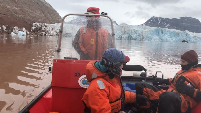
Cold day out on the fjordDoing bathymetry (“mowing the lawn”) on a very cold and wet morning.

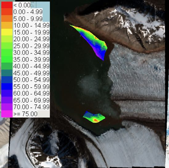
Some of the initial data that Kelly has been able to get from the bathymetry equipment reveals some shallow areas left behind by the retreating glaciers. It will be interesting to connect this data with the CTD data to see how the upwelling plumes are affecting the sediment deposits on the seafloor.
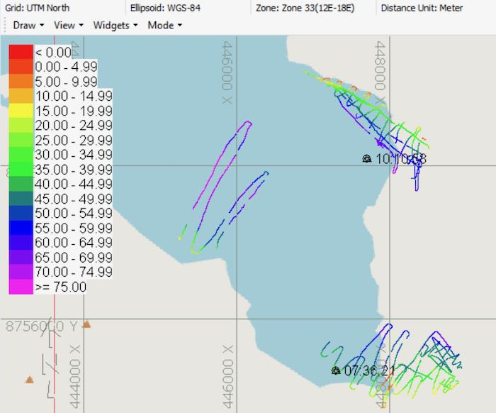
Bathymetric tracksThe tracks that we drove to capture the seafloor depth. The scale is in meters. (Note that the map overlay is out of date and doesn’t show the glacier retreat.) Bathymetric mapUsing software to “fill in the gaps”, Kelly was able to create an initial model of what these regions in front of the glaciers look like on the seafloor. The scale is in meters.
While we were patiently doing the bathymetry work, we got to watch several iceberg calving events. Check out this video of an incredible extended calving event as the archway above one of the upwelling plumes collapses.

One of the things to note is that calving of icebergs is a normal phenomenon. As the glacier ice flows forward, it will eventually reach the ocean and fall off the face. Seeing these events is not, in itself, evidence of climate change. However, we probably expect iceberg calving to occur more often as glaciers warm faster, as meltwater increases, and as they flow more quickly.

Done flying and near drone disaster

I made this tour on Saturday around the top of the glacier. Kongsvegen is so much more intact than Kronebreen, which looks like it's about to fall apart in front of our eyes. But we are also keeping an eye out for a glacial lake up on the glacier itself that another group is studying - they expect that to drain any day now. I'm curious how that will affect the movement of Kongsvegen and whether we'll be able to observe changes at the glacial face before we leave.
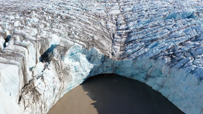
upwelling plume in Kongsvegen GlacierA close up of a large upwelling plume at Kongsvegen Glacier that we expect to begin draining quickly soon. Kongsvegen and Kronebreen Glaciers View (from the drone) across the top of Kongsvegen glacier looking over towards Kronebreen Glacier. Notice how much flatter the top is and how much tighter the crevasses are compared to Kronebreen in the background.
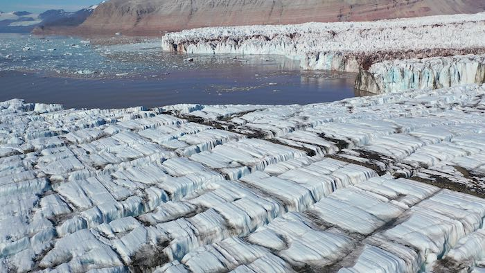
Yesterday after the weather improved I had an opportunity to do some drone flying to get good visual imagery of the upwelling plumes. Check out this video clip, where you’ll see water gushing out from several places. (I am having some fun with video editing and adding music!) It’s already interesting to see how the drone video is useful for documenting short-term changes to the glacier. Already in the past 5 days the amount of water coming out from under the glacier appears to be increasing. If you’re curious, compare yesterday’s video to this similar video that I took four days earlier.

As I was flying the drone yesterday, I got a bit overconfident and I let the battery get too low... and then had to make an emergency landing on shore. Then Xander and I hopped off the boat to go looking for the drone. Xander quickly loaded up the rifle (as a precaution against polar bears) and we went slogging up a steep hill in the area where I had performed the emergency landing. I was worried that we wouldn’t be able to find it, once I realized how much the little drone blends in with its surroundings.

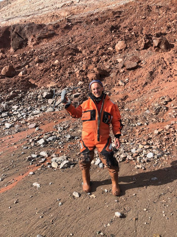
By some miracle we were able to find it sitting on top of the thick glacial till. I don't think it's any worse for wear! Xander and I got completely covered in mud, however. The glacial till is so muddy in places that we literally sank down to our waist!
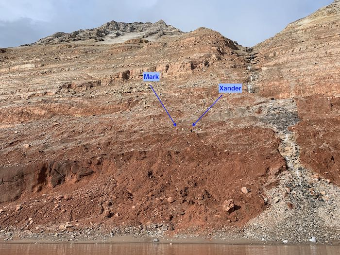
Searching for lost droneXander and I high up on the hillside searching for the lost drone. Drone found! I am greatly relieved to have found the drone! Notice how muddy my suit is after slogging through the glacial till!
After the happy retrieval of the drone and the sunny weather, we stayed out a bit longer to do some CTD and water testing work. It was a late night and we returned back to Ny Ålesund at around 7:30.
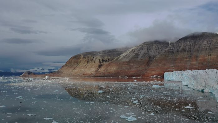
Out on the fjordView across the fjord yesterday (from the drone) as the weather began to improve.

Today is incredibly windy and there’s a storm coming through later this afternoon, so it’s not safe to go out in the boat. It feels good to take a little break from the hard work, catch up on data processing and emails (and write a blog post and respond to comments).
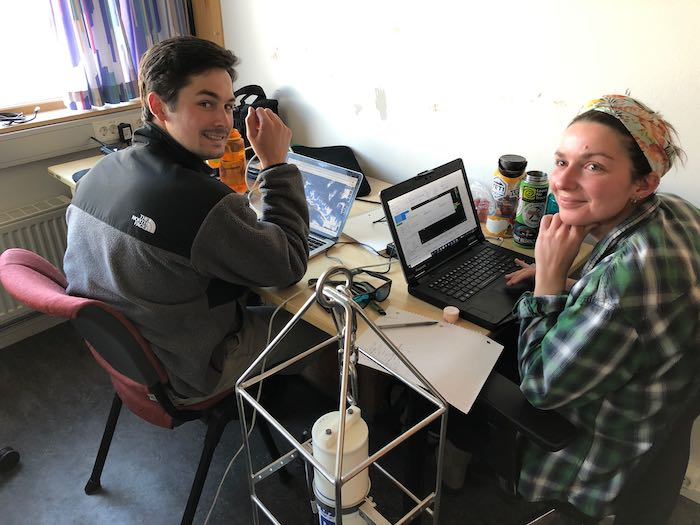
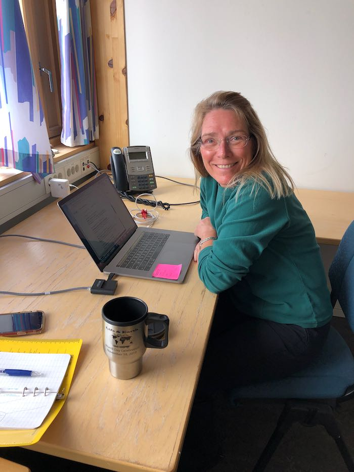
Office day Xander and Kelly working on our office day Office dayJulie working on our office day
Comments

Kathleen Yee

This is some great research that you guys are doing and I’m having lots of fun reading your journals!
I was wondering just out of curiosity if you would be able to tell in the second picture, how many years it would take for all the ice to melt? I was also wondering if you let the drone run out of battery in the sea would you go back for the drone or would it be to dangerous to go down and get it? I hope that you and your teammates find lots of discoveries and new things to teach the world about!
-Katie

Mark Goldner

Hi Katie, thanks for your questions. To answer your first question, a lot will depend on how much we as a society can control how much carbon dioxide we put into the atmosphere. If we can seriously limit our emissions now, then that will hopefully slow down the rate of melting. If not, scientists predict that the entire Arctic will be ice free within a few hundred years. More immediately, though, within probably 10-20 years the glaciers we are studying will have retreated away from the sea. This can have dramatic effects on the ecology of the region. For example, many seabirds depend on the nutrients that the glacier sediment can provide them. If the glaciers no longer flow to the sea, this could cut off a major food supply for them.

To answer you question about the drone - they are not waterproof! So it's always a risk flying them over open water. When I had my little emergency last week, I knew that I had to get the drone to land as soon as possible or it would end up in the ocean and be lost forever! So I was really lucky!

Isaac Ashton-R…

Hi Mr. Goldner It has been really fascinating reading your journals and I have a question about the equipment that you are using. What does the bathymetric equipment look like? Is the equipment big and heavy or is it small and light Weight? Does it have lots of parts to it? Can you hear the echo from the equipment at the surface of the water? I hope you find more interesting information there.

from Isaac

Mark Goldner

Hi Isaac! Great questions. In a future post I will try to send some images of the bathymetry equipment. It's pretty simple, though. There is a small transducer (a sound-making device) that is about the size of a small shoebox. That's on the end of a pole that is a couple of meters long. The transducer sits in the water, and, if you listen carefully you can hear it make its sounds - once every second. The transducer is connected to a controller and a battery, and the controller is connected to a computer and a GPS unit. We have a computer called a "toughbook" which is very water-resistant and suitable for using out in an open boat. All of the equipment is pretty lightweight - the whole thing weighs about 15-20 pounds. If we drive through thick ice - or if we are close to the glacier and icebergs calve off nearby - we sometimes have to pull it quickly out of the water, which is not too hard.

Jeffrey Dong

Hi, Mr. Goldner!

I hope you enjoyed your office day, as like you said, it's always nice to take a break every once in a while. I do have one nagging question, however. How long did it take you to find the drone? I know I never like it when I have to look for something, especially when it's in a place where I wouldn't really like to be. Did you get frustrated in the process?
Also, what do you think caused the "short-term changes to the glacier," as you said? Does the amount of water that gushes out from under the glacier keep increasing, every day, all the time? Or does it only do that occasionally?

A lot more great work out there!

Jeffrey

Mark Goldner

Hi Jeffrey, thanks for your questions. We were super lucky in finding the drone - it only took about 20 minutes. But I had a pretty good idea of where to look. I have since learned that the ipad I use to control the drone preserves the location information, so I might have been able to save a some time by using that. (Good to know for the future!)
Your second question gets to the heart of our research! We are not completely sure why some days there is much more water coming off the glacier than others. We expect to see more meltwater as summer goes on, but the fact that the meltwater doesn't flow consistently is not totally understood - also why the places where the water comes out can change over time. The other factor that plays a role is the water from the Atlantic Ocean flowing in. This year has been colder than usual here, which seems to be delaying the annual rise in ocean temperature that we expect to see. So, there are many factors and by monitoring what is happening we hope to get closer to understanding it all.

carter cagnina

Hello Mr. Goldner

It's really cool reading about your work and all the mountain and ice berg shots are absolutely stunning. The fact that you lost you lost your drone is terrible but it's good that you found it. My question is when do you think that most of those icebergs formed? My guess is about 100k years ago.

carter

Mark Goldner

Hi Carter, thanks for your question. I think most of the ice here is actually less old than you think. After the last Ice Age, the region got much warmer - and most of the ice melted. This was around 10,000 years ago. Then around 5,000 years ago it got colder again and the climate became what we have today and the ice sheets grew back to the size we have now. So I would guess that there is very little ice on Svalbard more than 10,000 years old.

Charlotte Pappas

Hello Mr. Goldner,

Foremostly, it is interesting how you observed that the Kronebreen and Kongsvegen Glaciers are receding. For example, from the video taken by your drone of the area around the edge of the Kongsvegen Glacier, I could see a lot of plied of sediment that likely used to be held by the Kongsvegen Glacier, but when the Kongsvegen Glacier started to recede, it no longer had enough ice to hold the sediment, so it deposited the sediment onto the ground.
In addition, the caption for the annotated satellite image of the Kronebreen and Kongsvegen Glaciers from 2011 states that the Kronebreen and Kongsvegen Glaciers are now 1.6 kilometers further back than where they were located in 2011.
I think that these pieces of evidence that you discovered can be used to prove that the affects of climate change are currently visible and it is causing drastic changes on the Earth, and that more actions should be taken to prevent climate change, in order to prevent it having a grater influence on the Earth's environment.

Moreover, I found the volume of ice that was lost from the Kronebreen Glacier by using the estimated distances on the picture of the part of the Kronebreen Glacier that has retreated. From this picture, I could tell that the length of the part of the Kronebreen Glacier that has receded is 1600 meters, its width is 3500 meters, and its combined hight of loss ice below the surface of the ocean, which is 60 meters high, and loss ice above the surface of the ocean, is 90 meters.
Therefore, based on these measurements, I can comprehend that the part of the Kronebreen Glacier that has retreated forms a rectangular prism, and based on my knowledge that to find the volume of a rectangular prism, you have to multiply its length by its width by its hight, to find the volume of the ice that was lost from the Kronebreen Glacier, I multiplied 1600 by 3500 by 90, which got me to the answer that the volume of the ice that was lost from the Kronebreen Glacier is 504,000,000 cubic meters.

Furthermore, I additionally found the answer to how much water the 504,000,000 cubic meters of ice that was lost from the Kronebreen Glacier would have added to the ocean, by using the information that the amount of melted ice from a glacier that gets added to the ocean is 90% the volume of the ice that was lost from the glacier. Hence, based on my knowledge that in order to find a precent of a total amount, you have to turn the precent into a decimal, and multiply it by the total amount, so to find the answer to how much water the5 04,000,000 cubic meters of ice that was lost from the Kronebreen Glacier would have added to the ocean, I multiplied 504,000,000 by 0.90, which got me to the answer that the the 504,000,000 cubic meters of ice that was lost from the Kronebreen Glacier would have added 453,600,000 cubic meters, which is equivalent to 119,750,400,000 gallons, of water to the ocean.

Finally, one wondering that I have after reading this post is that using the information from the volume of ice that melted from the Kronebreen Glacier from the past 10 years, and the current measurements of the glacier, what is the estimated volume of the ice from the that will melt from the Kronebreen Glacier in the next 10 years?

That is all of my thoughts for now.
Charlotte

Mark Goldner

Nice job on that little math problem, Charlotte! 119 billion gallons is indeed a huge amount of water, but it's a bit hard to wrap your head around. Here's another little problem for you to help make that more understandable: How many Olympic swimming pools full of water would that be?
It's hard for me to answer your second question, because we don't exactly know the rate of melting, and also at some point all or part of the glacier retreats to the land, where the melting rate can change. This is because it's no longer being as influenced by ocean water.

Kirtan Patel

Amazing journey Mark! Incredible videos and scientific work that brings climate change right to our eyes. So thankful for your work in educating us and the future about the real impacts of inadequate action.

Safiya Chander

Hi Mr.Goldner,
Its been very fun and cool reading about your findings. Its crazy to see how much the glaciers have changed in the past 10 years! I'm curious, what do you think the Kronebreen and Kongsvegan glaciers would look like if climate change didn't exist? Do you think it would be totally different? or do you think there would be only slight differences? Also, I'm so glad you found your drone! Now we can see more amazing images and videos of the glaciers! So excited to see what your next adventure is!
-Safiya

Mark Goldner

Hi Safiya! Thanks for your question. What's interesting about your question is that if humans weren't putting so much carbon dioxide and other greenhouse gases into the atmosphere, the climate would probably be cooling! Over the past 3 million years the Earth has gone through repeated cycles of Ice Ages and interglacial periods (warmer periods). This is because the Earth goes through periodic changes in the way it orbits around the Sun and spins on its axis (called Milankovitch Cycles). The interglacial periods typically last less time - maybe 10,000 years or so - and we should be slowly going back into an Ice Age. So without climate change, the glaciers might have been slowly expanding!

Binny

I find the research you are doing very interesting, and the addition of the clips and pictures from the drone makes it even more interesting.
A couple of questions?
1. Did you get a chance to leave the boat last time you where their? If so, did you notice any changes to the surface?
2. Does the daily difference in the water coming of glacier bottom a normal phenomenon, or is it another sign for climate change?

Another feature I would add to your drone is a GPS transmitter or "find my drone", in case it has another emergency landing.
Can you get off the boat on Kongsvegen or Kronebreen glaciers? It looks like a perfect terrain for trail running - hoping over the crevasses.
Looks like you have a side job as a nature film photographer and editor.

Mark Goldner

Hi Binny! Yes, last time we were here we were able to hike around on land. It's odd to be walking on areas that were closer to the glacier last time - or even on the glacier - that are now completely exposed. Overall the surface is still very similar - wherever the glacier has recently receded the land is covered with thick mud and sand from all the sediments that are left behind. Some of the land is actually still full of ice under the sediment, so sometimes it's hard to tell where the glacier actually "ends". As the glacier gets farther away, the land tends to dry out more and become more firm to walk on.

As to your second question, it seems that more meltwater coming off the glacier would be connected to climate change, and that's exactly what we're exploring. The evidence is clear that with warming climate, there is more melting, and knowing exactly how that happens and how fast the changes occur is important for making future predictions.

I have learned since my drone "incident" that the ipad I use to control the drone actually preserves GPS location. So if I hadn't found the drone I would have been able to locate it with a GPS device, thankfully.

I would LOVE to do trail running up here. The problem is polar bears... It would be foolhardy to go running without an armed escort because the polar bear risk is high. And the armed escort would need to be on a bike or other vehicle, so there are not many places where I could do that.

Anonymous

Hi Mr.Goldner, Reading your journal entries is really cool. Just out of curiosity, why is there so much mud on the glacial tills?

Mark Goldner

Hi there! I'm glad you are enjoying the blog. As glaciers flow across the landscape, they grind up the bedrock beneath them and push it up in front and to the side. So you end up with massive deposits - long hills, really - of all this sediment. The size of the grains of sediment can vary from microscopic grains (which is called clay) all the way up to boulder-sized rocks. In areas with lots of clay and silt, if there's enough water in the sediment it can get super muddy.

Sarah Murphy

Hi Mr Goldner!
I really enjoy reading all of your journals. I think it is really cool the way that you are able to compare the photos from your previous journey and the photos you are currently taking. I have a question about that, since a lot of the glaciers are melting will the glaciers ever be able to go back to how they were before humans interfered with the climate and if so how long would that take? What I mean by that is if humans were to stop global warming would that melted ice ever be able to freeze again and “rebuild the glaciers,”will the glaciers never be we big as they were.
I also enjoyed reading the part about your journey to find your drone and I am wondering more about the glacier tills. I believe that glacier tills are formed from sediment building up, if that is correct how long does it take for the glacier tills to be formed. Also is it in anyway dangerous to climb onto one as you said that you were sinking, would it be possible to sink under, or to get your feet stuck.
Thank you for putting so much information and time into these journals, I am learning a lot.
Thanks,
Sarah Murphy

Mark Goldner

Hi Sarah, I'm really glad you enjoy reading the blog! Unfortunately it's not realistic to think about "refreezing" the glaciers. There's just way too much carbon dioxide in the atmosphere right now, which is what causes the atmosphere to warm up. It's possible to stabilize that amount, and maybe to bring it down somewhat (if we stop burning fossil fuels and engage in sustainable agricultural practices, for example). But to get the glaciers to grow again would require a very steep reduction in carbon dioxide. Even then, it would take a great deal of time for the climate to shift back. So the best we can hope for in the short term (like our lifetimes) is to slow down the retreat of these magnificent glaciers.

It takes hundreds of years for the hills you see in my photos to form through the accumulation of glacial till. And generally those hills (called moraines) form when the glacier stays in one place for a while. And yes, it can be dangerous in places to walk through glacial mud because you can sink quite deeply into it! I've definitely experienced getting my feet stuck and having a great deal of trouble pulling them back out!

Daphne Jones

Hi Mr Goldner!
Its amazing to hear about your discoveries and adventures. To hear about the rapid melting (a mile in 10 years), and see a video showing the water pouring out is frightening, and quite a wake up alarm to see the impact peoples actions are taking. For your question: "Can you calculate the volume of ice that was lost? And how much water would that have added to the ocean, if the water is 90% the volume of ice? (Note that 1 cubic meter is 264 gallons).", 90 x 1600 x 3500 = 504,000,000 cubic meters which is the volume of ice that was lost, and the amount of water added to the ocean is 119,750,400,000 gallons (504,000,000 x 0.9 x 264). During storms is there any danger of glaciers falling? Does the water testing tell you about the amount of water in that area that came from melted glaciers? If so, about how much of the water in that area is just melted glaciers? If not, is there any way to tell how much of the water comes from melted glaciers, and what does the water testing help to show you? Thanks!
-Daphne

Mark Goldner

Hi Daphne, nice job on the math! 119 billion gallons is an enormous amount of water, but it's a bit hard to wrap your head around that. So here's another little problem for you to help make that more understandable: How many Olympic swimming pools full of water would that be? (Also appropriate since the Olympics are going on now!)

I don't think that the amount that icebergs calve off the glacier would change much during a storm. You have to realize the scale we're dealing with here and to understand that what makes icebergs calve off is mostly the force of the glacier moving forward, which is primarily due to its own gravity pulling it downhill, and also the amount of friction between the glacier and the bedrock below it. Those forces are pretty enormous compared to the force of wind, and rain from a storm. But of course I don't have any way of checking that since we'd be crazy to go out in the water during a storm. The risk to a boat from waves, wind, and the floating ice would make it really dangerous.

As for the water testing, it doesn't directly tell us how much water is melting off the glaciers, but it can help us understand how the water flows out from the glaciers. This can be helpful in creating models about how glaciers behave and how they will change in the future. This is useful for helping predict how future climate change will affect things like sea level rise and how ocean currents may change, for example.

Ishara B

Mr. Goldner,
It's amazing that you found the drone! This post was super interesting to read. My question is, obviously, we want to try to prevent this, but if nothing changes, and global warming continues, how long do you think it will take for the icebergs to melt completely?
-Ishara

Mark Goldner

Hi Ishara, thanks for your question. It's important to understand the difference between glaciers and icebergs. Glaciers are the massive rivers of ice that we're studying and that you see in my photos and videos. Icebergs are small pieces that break off into the water. So I think your question is really how long it will take for the glaciers to melt completely. Scientists aren't completely sure when exactly all the glaciers will melt (if we do nothing to prevent global warming) but I think there is consensus that most of the glaciers on Svalbard will be gone by the middle of the next century. And that probably the ice in Greenland will be gone in the next 1000 years. Those time scales might seem like a long way off, but that's for the ice to be gone completely. Even if the ice isn't completely gone, the amount of water that will melt into the ocean will still be enormous and can still cause enormous changes.

Eli Hoffman

Hi Mr. Goldner,
As I’ve been following your journey I’ve been very intrigued by the drone flying you have been doing. It’s been very cool to see all the progress you’ve made with the drone. All of the videos look very professional and I wouldn’t have guessed that you only started a few months ago.

I saw that a student help you start learning to fly your drone but I was wondering if there was any other people or things that helped you get better at flying drones?

Mark Goldner

Thanks, Eli! It's amazing what a great camera - and some editing in iMovie - can do for an amateur like me! The technology behind these drones is really quite amazing. The fact that the drone can hover in one place and keep its camera steady is remarkable. That I can use the device from so far away with such control made the footage possible. And then, the fact that it has the ability to fly itself home when you do lose control of the transmission (which happened a couple of times) is a great safety feature.

I was really lucky to have Rowan Packard give me a lesson in drone flying, and then I also went out to UMASS for a day in June where a student there gave me an additional flying lesson. Then I just flew a lot before I left to get some practice. I still have a lot to learn, and I think it takes a long time to get the drone controls to feel completely natural. I'm not a gamer, but I imagine it's like learning to play a complex video game - eventually you just train yourself to move a certain way without having to think about it. I'm not there yet!

Anonymous

I'm glad that you didn't lose the drone and that your able to create these beautiful videos of the glaciers for us to watch! It's crazy to think that 15,000 years ago Boston looked like the picture above, I'm wondering how long will it take for these glaciers to melt completely? I'm also assuming that global warming will speed up this process. The calving video was really cool, what factors cause calving? I really enjoyed reading your blog!

Eva

Mark Goldner

Hi Eva, thanks for your comment and questions. Yes, it's pretty cool to see what it looks like right after a glacier has retreated a bit, which give me a sense of what it looked like here at the end of the last Ice Age! For the glaciers to melt completely will probably take several hundred more years. But long before that the loss of ice will be enough to cause significant sea level rise and other changes to the planet. What I hope for is that we can slow down this process and maybe stop it before the glaciers completely disappear. Calving of icebergs is a normal process - not because of global warming. What happens is that some glaciers (like Kronebreen and Kongsvegen) flow all the way down into the ocean. At the edge of the glacier (called the terminus), some of the ice will be sort of hanging out over the water. This is, of course, very unstable, and as the ice behind it pushes on the ice at the terminus, some of the ice at the terminus will fall off into the water. What's cool is that if you watch time lapse videos of glaciers over, say, several months, you can see the glacier marching along pushing the ice at the front off, but the edge of the glacier stays pretty stable. Check out this website that has some very cool time lapse videos of the Kronebreen Glacier (it's several years old but still worth watching to get a sense of how this process works).

Travis Appelbaum

Hi Mr.Goldner,
I found it very interesting how much the ice has changed in the past 10 years. The photos you took really showed me how much the ice changed. It is unfortunate that global warming is making such a big impact on the arctic. One question I have is if melting continues at this rate, how long before it is dangerous for polar bears and other animals' survival.
Thanks, Travis

Mark Goldner

Hi Travis, this is an important question, because it would be helpful to know how much time we have before it's too late. I am not sure of the answer, but one way to look at the question is through the idea of "tipping points". What this means is that although we are probably a long ways off from the polar bears going extinct, there is probably a time not too far in the future when we will hit a tipping point - like a point of no return. After that point it may take a long time for them to go extinct, but because these things take time to occur we would already be beyond the point where they have a chance of survival. Again, I'm not sure when that tipping point is, but my guess is within ten years...

Add new comment