The past few days have been very busy, so I haven’t had much time to create a blog post. So I’ll catch you up on what we’ve been doing since Friday.
Evidence of Ice Retreat
The sonar bathymetry equipment (for mapping the seafloor depth) is finally working, so we spent the days slowly driving lines in front of the glacier face. We are mapping out exposed sea floor that ten years ago was covered with well over 100 feet of ice. Very clear evidence of a glacier retreating fast due to climate change.
Saturday was gorgeous - warm and sunny, so I was also able to do some drone flying. I took this flight around an outwash plain that was at the very edge of the Kongsvegen Glacier in 2011. Now it is at least a mile in front of this rapidly retreating glacier. Aside from the music, the video is pretty rough. In the next couple of months I’d like to turn this into a little educational video illustrating the different types of features that become exposed once the glacier retreats. I keep reminding myself that this sort of landscape is probably what it looked like in the Boston area around 15,000 years ago as the ice sheets retreated at the end of the last Ice Age!
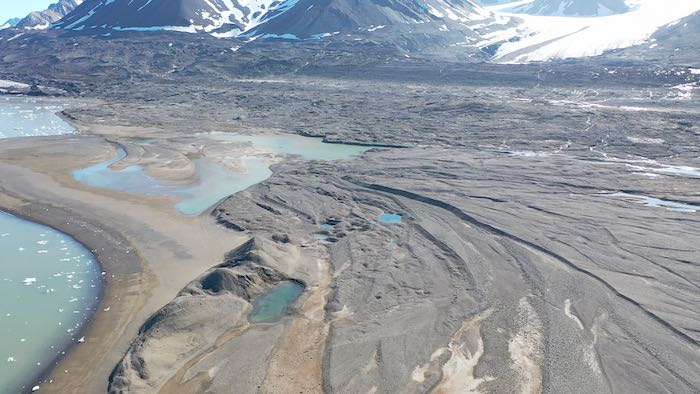 This outwash plain probably looks the way Boston did 15,000 years ago just as the ice sheets were retreating!
You can see one of my flight paths in the image below, which I brought into Google Earth and overlaid on a very recent satellite image. Then I compared this to a satellite image from August 2011. From these images you can see that the ice margin has retreated around 1.6km (1 mile) in the past 10 years.
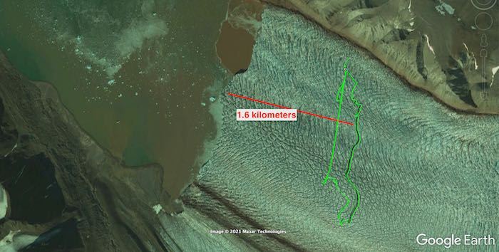 Satellite image of the Kronebreen and Kongsvegen Glaciers from 2011. Note that the ice is now 1.6km further back.
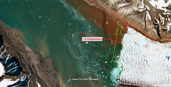 Satellite image of the Kronebreen and Kongsvegen Glaciers from 2021. Note that the ice is now 1.6km further back than in the 2011 image.
It’s important to realize that when all that ice retreats, all of that volume is gone. Consider the picture below, where I measured out (using Google Earth) the approximate distance of retreat and the approximate distance across the fjord. From the image it is possible to estimate where the height of the glacier was - by looking for the top of what we call glacial till - all the loose sediments that the glacier has left behind. From the drone estimate that the glacier was about 30 meters above the surface. I’m also making a guess that the glacier was, on average, around 60 meters below the surface.
For my students (and anyone else): Can you calculate the volume of ice that was lost? And how much water would that have added to the ocean, if the water is 90% the volume of ice? (Note that 1 cubic meter is 264 gallons.
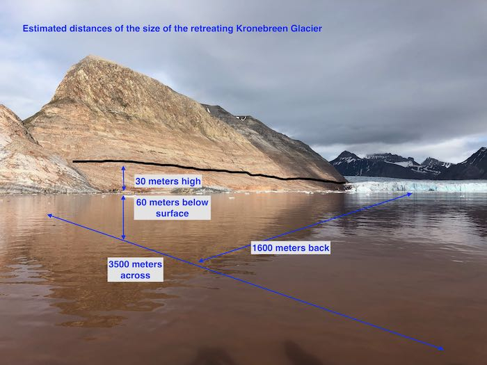 This image shows how far back the ice from Kronebreen Glacier has retreated. Use the values in the image to calculate how much ice has melted and how much water has been added to the ocean.
Slow and Steady
Yesterday was spent continuing the bathymetric work. The way the equipment works is a sound wave is sent downward every second, and based on the time it takes for the echo to return, the distance is calculated (because the instrument is programmed with the speed of sound in water). The instrument is connected to a GPS device, and the computer logs the depth and GPS coordinates. Kelly has been working so hard to get the equipment up and running and troubleshooting it.
Doing bathymetry is very slow work. The boat has to move very slowly (around 2 knots or less) to ensure accurate depth readings. And because we’re just taking one point at a time, we need to go back and forth across a region to get the map created. Julie calls this “mowing the lawn”!
Sunday we spent about 5 hours mapping, and yesterday we spent another 7+ hours out on the fjord. Yesterday started out quite cold and rainy. And when you are sitting in a boat on ~36° water in the cold rain your feet get pretty cold. I’m not sure that I have ever felt such cold toes before yesterday! It’s worth it, though, because we are starting to see features underwater that we had no idea were there. For example, it looks like there is a fan-looking feature in front of the upwelling plumes, probably caused by the buildup of intense sediment outflow coming off the glacier.
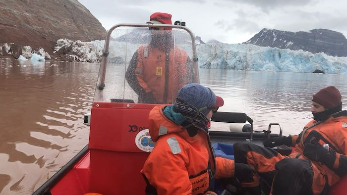 Doing bathymetry (“mowing the lawn”) on a very cold and wet morning.
Some of the initial data that Kelly has been able to get from the bathymetry equipment reveals some shallow areas left behind by the retreating glaciers. It will be interesting to connect this data with the CTD data to see how the upwelling plumes are affecting the sediment deposits on the seafloor.
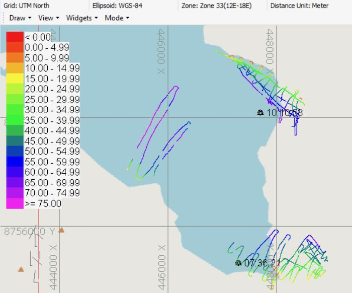 The tracks that we drove to capture the seafloor depth. The scale is in meters. (Note that the map overlay is out of date and doesn’t show the glacier retreat.)
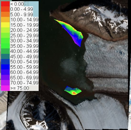 Using software to “fill in the gaps”, Kelly was able to create an initial model of what these regions in front of the glaciers look like on the seafloor. The scale is in meters.
While we were patiently doing the bathymetry work, we got to watch several iceberg calving events. Check out this video of an incredible extended calving event as the archway above one of the upwelling plumes collapses.
One of the things to note is that calving of icebergs is a normal phenomenon. As the glacier ice flows forward, it will eventually reach the ocean and fall off the face. Seeing these events is not, in itself, evidence of climate change. However, we probably expect iceberg calving to occur more often as glaciers warm faster, as meltwater increases, and as they flow more quickly.
Done flying and near drone disaster
I made this tour on Saturday around the top of the glacier. Kongsvegen is so much more intact than Kronebreen, which looks like it's about to fall apart in front of our eyes. But we are also keeping an eye out for a glacial lake up on the glacier itself that another group is studying - they expect that to drain any day now. I'm curious how that will affect the movement of Kongsvegen and whether we'll be able to observe changes at the glacial face before we leave.
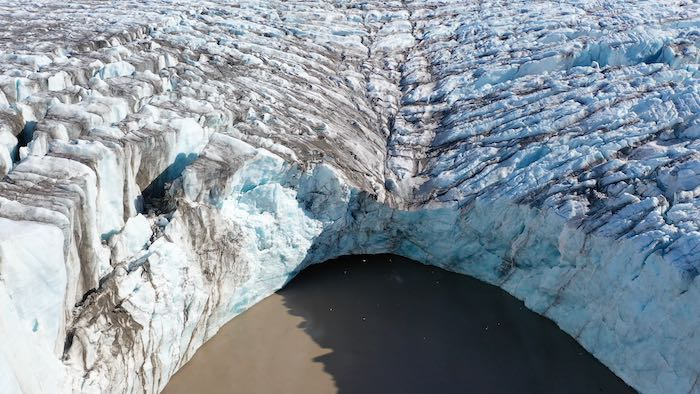 A close up of a large upwelling plume at Kongsvegen Glacier that we expect to begin draining quickly soon.
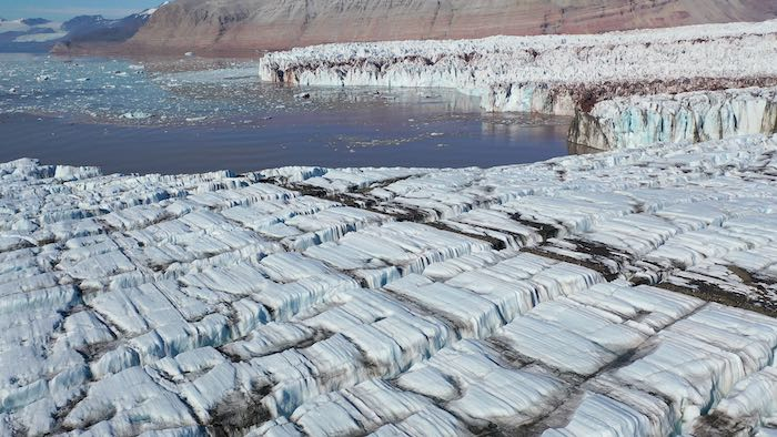 View (from the drone) across the top of Kongsvegen glacier looking over towards Kronebreen Glacier. Notice how much flatter the top is and how much tighter the crevasses are compared to Kronebreen in the background.
Yesterday after the weather improved I had an opportunity to do some drone flying to get good visual imagery of the upwelling plumes. Check out this video clip, where you’ll see water gushing out from several places. (I am having some fun with video editing and adding music!) It’s already interesting to see how the drone video is useful for documenting short-term changes to the glacier. Already in the past 5 days the amount of water coming out from under the glacier appears to be increasing. If you’re curious, compare yesterday’s video to this similar video that I took four days earlier.
As I was flying the drone yesterday, I got a bit overconfident and I let the battery get too low... and then had to make an emergency landing on shore. Then Xander and I hopped off the boat to go looking for the drone. Xander quickly loaded up the rifle (as a precaution against polar bears) and we went slogging up a steep hill in the area where I had performed the emergency landing. I was worried that we wouldn’t be able to find it, once I realized how much the little drone blends in with its surroundings.
By some miracle we were able to find it sitting on top of the thick glacial till. I don't think it's any worse for wear! Xander and I got completely covered in mud, however. The glacial till is so muddy in places that we literally sank down to our waist!
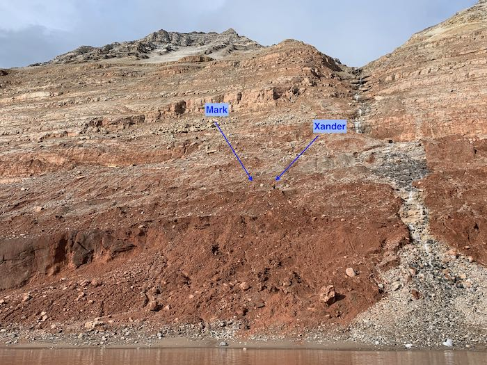 Xander and I high up on the hillside searching for the lost drone.
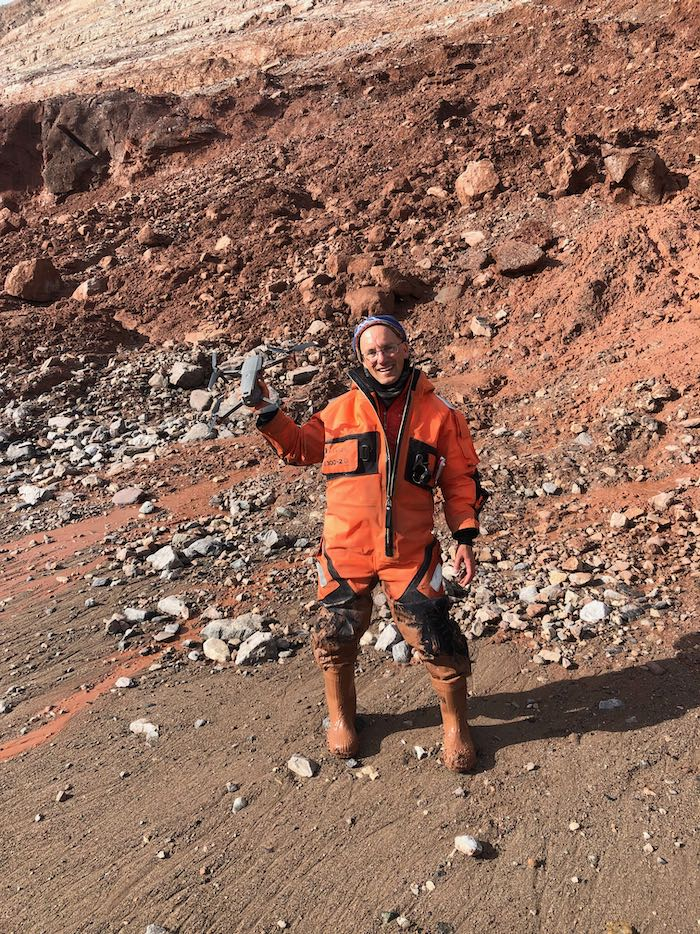 I am greatly relieved to have found the drone! Notice how muddy my suit is after slogging through the glacial till!
After the happy retrieval of the drone and the sunny weather, we stayed out a bit longer to do some CTD and water testing work. It was a late night and we returned back to Ny Ålesund at around 7:30.
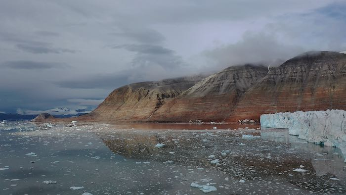 View across the fjord yesterday (from the drone) as the weather began to improve.
Today is incredibly windy and there’s a storm coming through later this afternoon, so it’s not safe to go out in the boat. It feels good to take a little break from the hard work, catch up on data processing and emails (and write a blog post and respond to comments).
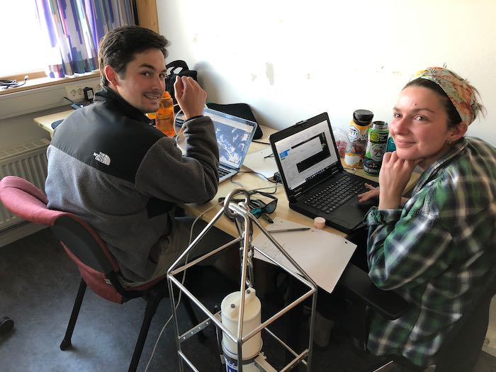 Xander and Kelly working on our office day
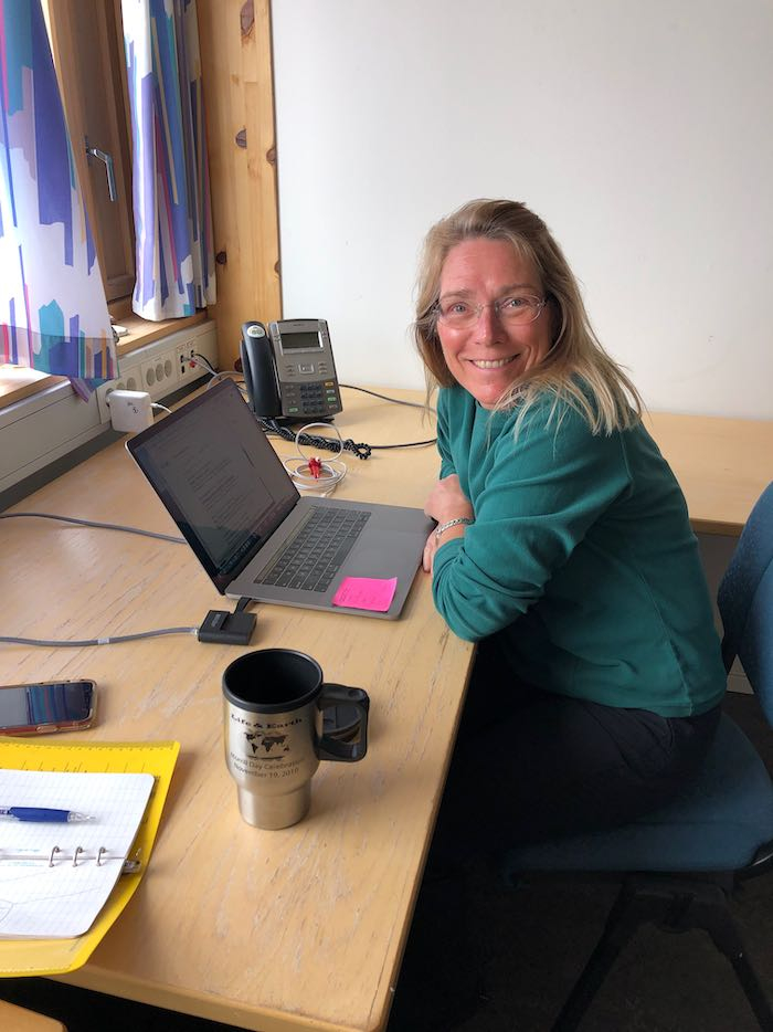 Julie working on our office day

Comments
Add new comment